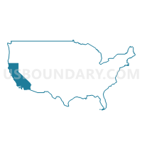
San Diego County (Northwest)--Escondido City (East) PUMA, California
About
Outline
--Escondido+City+(East)+PUMA%2c+California_A280.png)
Summary
| Unique Area Identifier | 192307 |
| Name | San Diego County (Northwest)--Escondido City (East) PUMA |
| State | California |
| Area (square miles) | 102.72 |
| Land Area (square miles) | 101.39 |
| Water Area (square miles) | 1.33 |
| % of Land Area | 98.70 |
| % of Water Area | 1.30 |
| Latitude of the Internal Point | 33.13145410 |
| Longtitude of the Internal Point | -117.01711660 |
Maps
Graphs
Select a template below for downloading or customizing gragh for San Diego County (Northwest)--Escondido City (East) PUMA, California
--Escondido+City+(East)+PUMA%2c+California_T0.png)
--Escondido+City+(East)+PUMA%2c+California_T1.png)
--Escondido+City+(East)+PUMA%2c+California_T2.png)
--Escondido+City+(East)+PUMA%2c+California_T3.png)
--Escondido+City+(East)+PUMA%2c+California_T4.png)
--Escondido+City+(East)+PUMA%2c+California_T5.png)
--Escondido+City+(East)+PUMA%2c+California_T6.png)
--Escondido+City+(East)+PUMA%2c+California_T7.png)
Neighbors
Neighoring Public Use Microdata Area (by Name) Neighboring Public Use Microdata Area on the Map
- San Diego County (Central)--Lakeside, Winter Gardens & Ramona PUMA, CA
- San Diego County (Central)--San Diego (Northeast/Rancho Bernardo) & Poway Cities PUMA, CA
- San Diego County (North & East)--Fallbrook, Alpine & Valley Center PUMA, CA
- San Diego County (Northwest)--San Marcos & Escondido (West) Cities PUMA, CA
- San Diego County (Northwest)--Vista City PUMA, CA
- San Diego County (West)--San Diego (Northwest/San Dieguito) & Encinitas Cities PUMA, CA
Top 10 Neighboring County (by Population) Neighboring County on the Map
Top 10 Neighboring County Subdivision (by Population) Neighboring County Subdivision on the Map
- San Diego CCD, San Diego County, CA (2,259,481)
- Oceanside-Escondido CCD, San Diego County, CA (627,851)
- Ramona CCD, San Diego County, CA (34,870)
- Valley Center CCD, San Diego County, CA (23,330)
- Palomar-Julian CCD, San Diego County, CA (6,267)
Top 10 Neighboring Place (by Population) Neighboring Place on the Map
- San Diego city, CA (1,307,402)
- Escondido city, CA (143,911)
- Poway city, CA (47,811)
- Valley Center CDP, CA (9,277)
- Hidden Meadows CDP, CA (3,485)
Top 10 Neighboring Elementary School District (by Population) Neighboring Elementary School District on the Map
- Escondido Union Elementary School District, CA (161,430)
- San Pasqual Union Elementary School District, CA (3,230)
Top 10 Neighboring Secondary School District (by Population) Neighboring Secondary School District on the Map
Top 10 Neighboring Unified School District (by Population) Neighboring Unified School District on the Map
- Poway Unified School District, CA (188,229)
- Valley Center-Pauma Unified School District, CA (24,678)
Top 10 Neighboring State Legislative District Lower Chamber (by Population) Neighboring State Legislative District Lower Chamber on the Map
- Assembly District 66, CA (566,937)
- Assembly District 75, CA (493,641)
- Assembly District 74, CA (492,971)
- Assembly District 77, CA (444,726)
Top 10 Neighboring State Legislative District Upper Chamber (by Population) Neighboring State Legislative District Upper Chamber on the Map
Top 10 Neighboring 111th Congressional District (by Population) Neighboring 111th Congressional District on the Map
- Congressional District 49, CA (797,428)
- Congressional District 50, CA (753,135)
- Congressional District 52, CA (673,893)
Top 10 Neighboring Census Tract (by Population) Neighboring Census Tract on the Map
- Census Tract 170.30, San Diego County, CA (17,064)
- Census Tract 171.10, San Diego County, CA (10,622)
- Census Tract 201.03, San Diego County, CA (10,235)
- Census Tract 191.06, San Diego County, CA (9,131)
- Census Tract 207.09, San Diego County, CA (8,007)
- Census Tract 170.15, San Diego County, CA (7,295)
- Census Tract 203.07, San Diego County, CA (7,170)
- Census Tract 202.11, San Diego County, CA (6,702)
- Census Tract 202.02, San Diego County, CA (6,689)
- Census Tract 207.06, San Diego County, CA (6,286)
Top 10 Neighboring 5-Digit ZIP Code Tabulation Area (by Population) Neighboring 5-Digit ZIP Code Tabulation Area on the Map
- 92027, CA (53,881)
- 92025, CA (49,978)
- 92026, CA (48,922)
- 92128, CA (47,490)
- 92127, CA (39,337)
- 92065, CA (35,414)
- 92082, CA (19,037)
- 92029, CA (19,021)


--Escondido+City+(East)+PUMA in California.png)

--Escondido+City+(East)+PUMA%2c+California.png)